
Deep Learning Applications
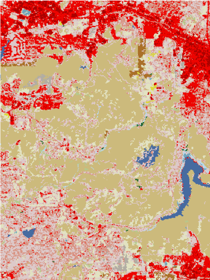
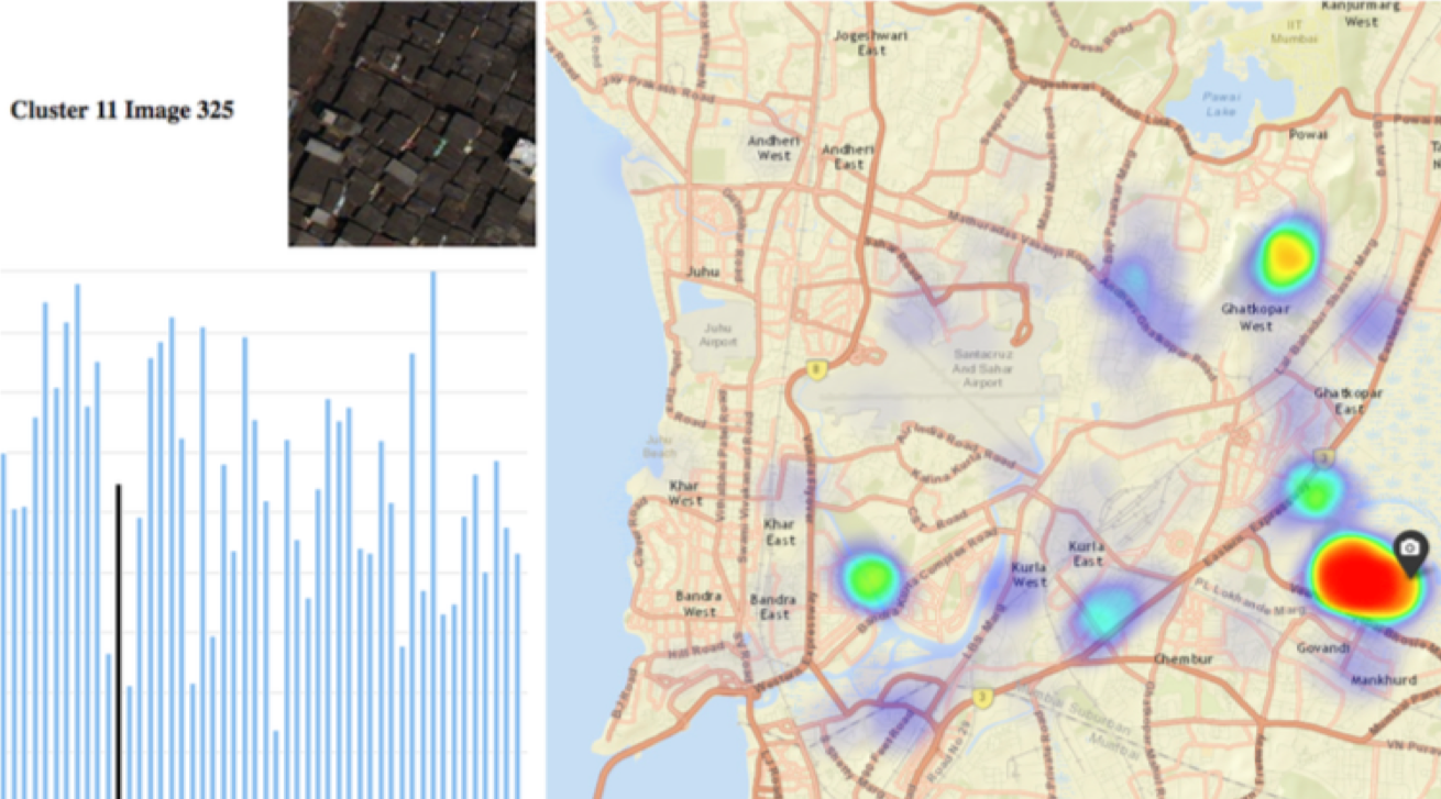
Demographics Analysis Using Satellite ImageryHigh resolution satellite imagery is a growing source of data with significant efficiency and cost benefits for evaluating the socio-economic demographics of neighborhoods. While the benefits of satellite imagery has created a lot of excitement, a new challenge is that the volume of high resolution satellite imagery is computationally expensive. To alleviate the volume of “Big Image Data”, machine learning is a promising tool to automatically sift through and retrieve relevant image. In this research, we present a framework for organizing collections of satellite images into demographically relevant categories using unsupervised learning techniques. Our framework first extracts features using pre-trained convolutional neural networks from tiles of high resolution satellite images of a city. Cluster analysis is then applied to these features to organize images into visually similar groups. The resulting image clusters are visualized in our customized web interface to enable demographers, social scientists, and economists to understand the organization of a city.
|
 |
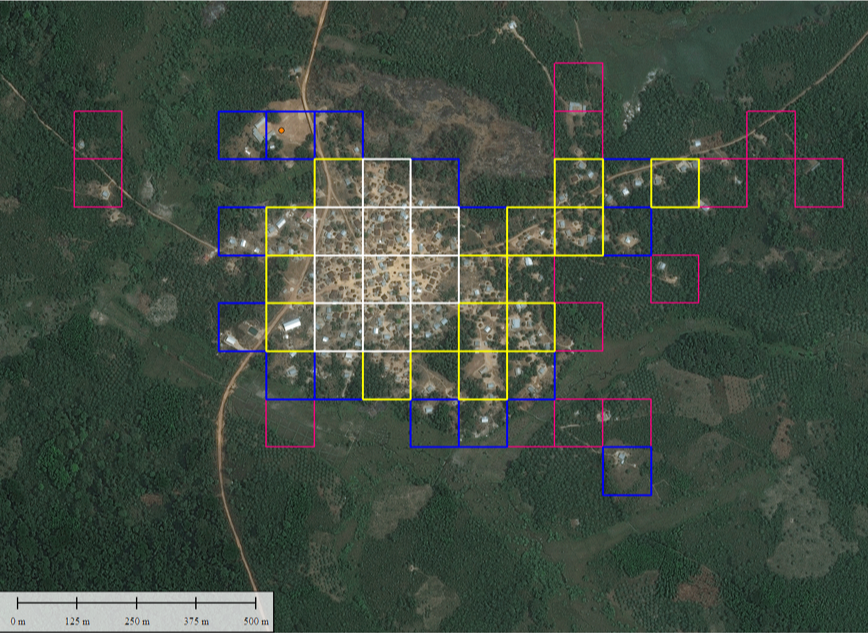 |
Locating Schools in Rural LiberiaThis project addresses the problem of locating schools in rural regions of Liberia through the use of deep learning to analyze high-resolution satellite images. Accurate data about schools and their infrastructure is needed to guide aid workers, policy makers, and philanthropic organizations in allocating essential resources in order to improve educational opportunities. In this work, we use unsupervised learning methods with deep learning models to analyze satellite images at scale. Our approach provides a way to quickly filter out irrelevant data in a scene to identify regions of interest. Our results suggest that using machine learning with high resolution satellite images can reduce the search space to effectively filter out likely school locations from background image tiles. |
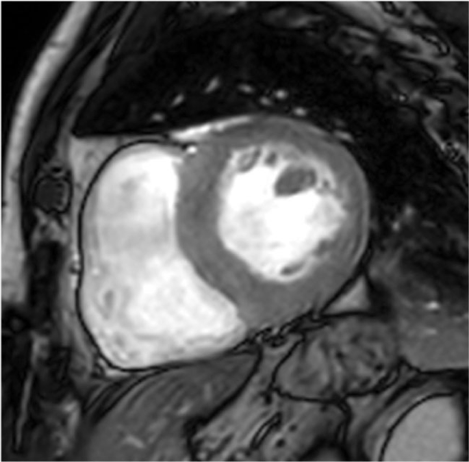
Cardiac Image AnalysisWe are researching techniques to perform automatic left ventricle (LV) segmentation and volume estimation from cardiac magnetic resonance imaging (MRI). The LV is the largest chamber in the heart and plays a critical role in cardiac function. Cardiac imaging such as MRI provides an non-invasive way to study cardiac structure and function, and is an invaluable tool in heart disease diagnosis. However, the process of analyzing cardiac images to perform LV segmentation is time-consuming, labor-intensive, and error-prone. Automating this process is thus essential in providing efficient and consistent analysis of cardiac images for diagnosing heart disease. We are applying deep and machine learning methods to create an analytics pipeline to automate this process. As part of this research, we investigate methods for preprocessing cardiac images, performing semantic segmentation of the LV, as well as estimating LV volume.
|
 |